
Ph_locator_region_1.png (300 × 440 படவணுக்கள், கோப்பின் அளவு: 17 KB, MIME வகை: image/png)
| இது விக்கிமீடியா பொதுக்கோப்பகத்தில் இருக்கும் ஒரு கோப்பாகும். இக்கோப்பைக் குறித்து அங்கே காணப்படும் படிம விளக்கப் பக்கத்தை இங்கே கீழே காணலாம். |
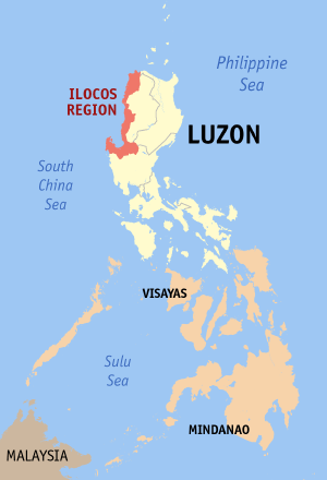
Map of the Philippines showing the location of Ilocos Region (Region I).
Source: English wikipedia
 | GNU Free Documentation License விதிமுறைகளின் கீழ் இந்த ஆவணத்தை நகலெடுக்க, விநியோகிக்க மற்றும்/அல்லது மாற்றுவதற்கு அனுமதி வழங்கப்பட்டுள்ளது, Free Software Foundation;ஆல் வெளியிடப்பட்ட பதிப்பு 1.2 அல்லது அதற்குப் பிந்தைய பதிப்பு, மாற்றமில்லாத பிரிவுகள், முன் அட்டை உரைகள் மற்றும் பின் அட்டை உரைகள் இல்லாமல் வெளியிடப்பட்டது. GNU Free Documentation License என்ற தலைப்பில் உரிமத்தின் நகல் சேர்க்கப்பட்டுள்ளது.http://www.gnu.org/copyleft/fdl.htmlGFDLGNU Free Documentation Licensetruetrue |
| இந்த கோப்பு Creative Commons Attribution-Share Alike 3.0 Unported உரிமத்தின் கீழ் உள்ளது. | ||
| ||
| This licensing tag was added to this file as part of the GFDL licensing update.http://creativecommons.org/licenses/by-sa/3.0/CC BY-SA 3.0Creative Commons Attribution-Share Alike 3.0truetrue |
குறித்த நேரத்தில் இருந்த படிமத்தைப் பார்க்க அந்நேரத்தின் மீது சொடுக்கவும்.
| நாள்/நேரம் | நகம் அளவு சிறுபடம் | அளவுகள் | பயனர் | கருத்து | |
|---|---|---|---|---|---|
| தற்போதைய | 12:01, 2 மே 2006 | | 300 × 440 (17 KB) | Magalhães | updated version (2nd try) |
| 08:45, 1 மே 2006 |  | 300 × 440 (17 KB) | Magalhães | updated version | |
| 13:28, 9 ஆகத்து 2005 |  | 300 × 450 (11 KB) | Magalhães | Map of The Philippines showing the location of Ilocos Region (Region I). Source: [http://en.wikipedia.org/wiki/Image:Ph_locator_region_1.png English wikipedia] {{GFDL}} Category: Maps of the Philippines |
பின்வரும் பக்க இணைப்புகள்இப் படிமத்துக்கு இணைக்கபட்டுள்ளது(ளன):
கீழ்கண்ட மற்ற விக்கிகள் இந்த கோப்பை பயன்படுத்துகின்றன: