Nomenclature of Territorial Units for Statistics or NUTS (French: Nomenclature des unités territoriales statistiques) is a geocode standard for referencing the administrative divisions of countries for statistical purposes.[1][2][3][4][5][6] The standard, adopted in 2003,[7] is developed and regulated by the European Union, and thus only covers the EU member states in detail. The Nomenclature of Territorial Units for Statistics is instrumental in the European Union's Structural Funds and Cohesion Fund delivery mechanisms and for locating the area where goods and services subject to European public procurement legislation are to be delivered.

For each EU member country, a hierarchy of three NUTS levels is established by Eurostat in agreement with each member state; the subdivisions in some levels do not necessarily correspond to administrative divisions within the country. A NUTS code begins with a two-letter code referencing the country, as abbreviated in the European Union's Interinstitutional Style Guide.[8] The subdivision of the country is then referred to with one number. A second or third subdivision level is referred to with another number each. Each numbering starts with 1, as 0 is used for the upper level. Where the subdivision has more than nine entities, capital letters are used to continue the numbering. Below the three NUTS levels are local administrative units (LAUs). A similar statistical system is defined for the candidate countries and members of the European Free Trade Association, but they are not part of NUTS governed by the regulations.
The current NUTS classification, dated 21 November 2016 and effective from 1 January 2018 (now updated to current members as of 2020[update]), lists 92 regions at NUTS 1, 244 regions at NUTS 2, 1215 regions at NUTS 3 level, and 99,387 local administrative units (LAUs).[9][10]
National structures
Not all countries have every level of division, depending on their size. For example, Luxembourg and Cyprus only have local administrative units (LAUs); the three NUTS divisions each correspond to the entire country itself.
Member states
| Countries | NUTS 1 | NUTS 2 | NUTS 3 | Local administrative units (LAU) | |||||
|---|---|---|---|---|---|---|---|---|---|
| Member State | 27 | 92 | 240 | 1,164 | 92,054 | ||||
| Austria | AT | Groups of states | 3 | States | 9 | Groups of districts | 35 | Municipalities (Gemeinden) | 2,093 |
| Belgium | BE | Regions | 3 | Provinces (+ Brussels) | 11 | Arrondissements (Verviers split into two) | 44 | Municipalities (gemeenten / communes) | 581 |
| Bulgaria | BG | Regions | 2 | Planning regions | 6 | Oblasts | 28 | Municipalities (общини, obshtini) | 265 |
| Croatia | HR | — | 1 | Regions | 4 | Counties (županije) + Zagreb | 21 | Municipalities (općine) | 556 |
| Cyprus | CY | — | 1 | — | 1 | — | 1 | Municipalities, communities (δήμοι, κοινότητες, dimoi, koinotites) | 615 |
| Czech Republic | CZ | — | 1 | Statistical areas | 8 | Administrative regions (kraje) | 14 | Municipalities (obce) | 6,254 |
| Denmark | DK | — | 1 | Regions (Regioner) | 5 | Provinces (Landsdele) | 11 | Municipalities (kommuner) and 1 unincorporated area | 99 |
| Estonia | EE | — | 1 | — | 1 | Groups of counties | 5 | Municipalities (Vald, linn) | 79 |
| Finland | FI | Mainland Finland, Åland | 2 | Large areas (Suuralueet / Storområden) | 5 | Regions (Maakunnat / Landskap) | 19 | Municipalities (kunnat / kommuner) | 309 |
| France | FR | Regions + DOM | 14 | Former regions (1982–2015) + DOM | 27 | Departments + DOM | 101 | Communes | 34,965 |
| Germany | DE | States (Bundesland) | 16 | Inconsistent, some whole States (Bundesland), some Government regions (Regierungsbezirk) (or equivalent, or dissolved) | 38 | Districts (Kreis) | 400 | Municipalities (Gemeinden) | 10,775 |
| Greece | EL[a] | Groups of development regions | 4 | Regions | 13 | Prefectures | 51 | Municipal districts/Community districts (δημοτικό διαμέρισμα, κοινότικο διαμέρισμα, demotiko diamerisma, koinotiko diamerisma) | 6,133 |
| Hungary | HU | Statistical large regions (statisztikai nagyrégiók) | 3 | Planning and statistical regions (tervezési-statisztikai régió) | 8 | Counties (vármegye) + Budapest | 20 | Settlements (települések) | 3,155 |
| Ireland | IE | — | 1 | Regions | 3 | Regional Authority Regions | 8 | Local electoral areas | 166 |
| Italy | IT | Groups of regions | 5 | Regions (Trentino-Alto Adige split into two) | 21 | Provinces | 107 | Municipalities (comuni) | 7,904 |
| Latvia | LV | — | 1 | — | 1 | Statistical regions | 6 | Municipalities, state cities (valstspilsētas, novadi) | 43 |
| Lithuania | LT | — | 1 | Vidurio ir vakarų Lietuvos regionas, Sostinės regionas | 2 | Counties | 10 | Municipalities (savivaldybės) | 60 |
| Luxembourg | LU | — | 1 | — | 1 | — | 1 | Communes (French: communes, German: Gemeinden, Luxembourgish: Gemengen) | 102 |
| Malta | MT | — | 1 | — | 1 | Islands | 2 | Local councils (kunsilli) | 68 |
| Netherlands | NL | Groups of provinces | 4 | Provinces | 12 | COROP regions | 40 | Municipalities (gemeenten) | 342 |
| Poland | PL | Macroregions (Makroregiony) | 7 | Voivodeships + Warsaw metro | 17 | Subregions (Podregiony) | 73 | Municipalities (gminy) | 2,477 |
| Portugal | PT | Continent + Azores + Madeira | 3 | Statistical regions + autonomous regions | 7 | Groups of municipalities | 25 | Municipalities (concelhos) | 308 |
| Romania | RO | Macroregions | 4 | Regions | 8 | Counties + Bucharest | 42 | Communes + Municipalities + Cities (comune + municipii + orașe) | 3,181 |
| Slovakia | SK | — | 1 | Oblasts | 4 | Regions (Kraje) | 8 | Municipalities (obce) | 2,891 |
| Slovenia | SI | — | 1 | Macroregions | 2 | Statistical regions | 12 | Municipalities (občine) | 212 |
| Spain | ES | Groups of autonomous communities | 7 | 17 Autonomous communities and 2 autonomous cities | 19 | Provinces + Islands + Ceuta and Melilla | 59 | Municipalities (municipios) | 8,131 |
| Sweden | SE | Regions (Grupper av riksområden) | 3 | National Areas (Riksområde) | 8 | Counties (Län) | 21 | Municipalities (kommuner) | 290 |
Candidate countries
| Country | NUTS 1 | NUTS 2 | NUTS 3 | LAU 1 | LAU 2 | ||||||
|---|---|---|---|---|---|---|---|---|---|---|---|
| Candidate countries | 5 | 17 | 36 | 131 | 1,202 | 47,235 | |||||
| Albania | AL | — | 1 | Regions (non-administrative) | 3 | Counties | 12 | – | – | Municipalities (Komunë) / Communes (Bashki / Komunë) | 373 |
| Montenegro | ME | — | 1 | — | 1 | Statistical Regions | 3 | Municipalities (општине, opštine) | 24 | Settlements (Насеља, naselja) | 1,256 |
| North Macedonia | MK | — | 1 | — | 1 | Statistical regions | 8 | Municipalities (општини, opštini) | 84 | Settlements (Населени места, naseleni mesta) | 1,776 |
| Serbia | RS | Groups of regions | 2 | Regions | 5 | Districts | 29 | Municipalities (општине и градови, opštine i gradovi) | 174 | Settlements (Насељена места, naseljena mesta) | 6,155 |
| Turkey | TR | Regions | 12 | Sub-regions | 26 | Provinces (iller) | 81 | Districts (ilçeler) | 923 | Municipalities (belediyeler) | 37,675 |
EFTA countries
| Country | NUTS 1 | NUTS 2 | NUTS 3 | LAU 1 | LAU 2 | ||||||
|---|---|---|---|---|---|---|---|---|---|---|---|
| EFTA countries | 4 | 4 | 16 | 48 | 265 | 2,567 | |||||
| Switzerland | CH | — | 1 | Regions | 7 | Cantons | 26 | Districts (German: Bezirke, Ämter and Amtsbezirke; French: districts; Italian: distretti; Romansh: districts) | 166 | Municipalities (German: Gemeinden, Einwohnergemeinden and politische Gemeinden; French: communes; Italian: comuni; Romansh: vischnancas) | 2,136 |
| Iceland | IS | — | 1 | — | 1 | Capital Region / Rest of country | 2 | Regions (landshlutar) | 8 | Municipalities (sveitarfélag) | 64 |
| Liechtenstein | LI | — | 1 | — | 1 | — | 1 | Electoral districts (Landschaften) | 2 | Municipalities (Gemeinden) | 11 |
| Norway | NO | — | 1 | Regions | 7 | Counties (Fylke) | 19 | Economic regions (Økonomiske regioner) | 89 | Municipalities (kommuner) | 356 |
Former EU member-state
The United Kingdom left the European Union on 31 January 2020, the only member-state to ever do so.
| Country | NUTS 1 | NUTS 2 | NUTS 3 | LAU | |||||
|---|---|---|---|---|---|---|---|---|---|
| United Kingdom | UK[b] | Regions of England | 9 | Sub-Regions ≍ i: ∪ of counties; or | 30 | Upper tier authorities and groups of unitary authorities and districts | 93 | Districts or unitary authorities | 326 |
| Wales | 1 | Groups of Principal Areas | 2 | Groups of Principal Areas | 12 | Principal Areas | 22 | ||
| Scotland | 1 | Groups of Council and/or Island Areas | 4 | Groups of Council Areas or Islands Areas | 23 | Council areas, subdivided by LEC where applicable | 41 | ||
| Northern Ireland | 1 | — | 1 | Groups of districts | 5 | Districts | 11 | ||
Maps
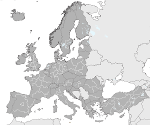 NUTS 1 in Europe
 NUTS 2 in Europe
 NUTS 3 in Europe


.svg)
Establishment
NUTS regions are generally based on existing national administrative subdivisions. In countries where only one or two regional subdivisions exist, or where the population of existing subdivisions is too small or too large, a second and/or third level is created. This may be on the first level (ex. France, Italy, Greece, and Spain), on the second (ex. Germany) and/or third level (ex. Belgium).[11] In countries with small populations, where the entire country would be placed on the NUTS 2 or even NUTS 3 level (ex. Luxembourg, Cyprus), the regions at levels 1, 2 and 3 are identical to each other (and also to the entire country), but are coded with the appropriate length codes levels 1, 2 and 3.
The NUTS system favors existing administrative units, with one or more assigned to each NUTS level. Specific guidelines are based in population, leaving little or no role for other types of variables such as area, distance, topography, levels of jurisdiction or history, which can only be considered in (unspecified) types of special cases.[12] From the NUTS Regulation, the average population size of the regions in the respective level shall lie within the following thresholds:
| Level | Minimum | Maximum |
|---|---|---|
| NUTS 1 | 3 million | 7 million |
| NUTS 2 | 800,000 | 3 million |
| NUTS 3 | 150,000 | 800,000 |
For non-administrative units, deviations from these population marks exist for particular geographical, socio-economic, historical, cultural or environmental circumstances, especially for islands and outermost regions.
Examples
- IT: Italy
- ITC: Northwest Italy
- ITC1: Piedmont
- ITC11: Metropolitan City of Turin
- ITC1: Piedmont
- ITC: Northwest Italy
See also
Notes
References
External links
 NUTS code (P605) (see uses)
