Kabul
capital and the largest city of Afghanistan
Kabul is the capital and largest city of Afghanistan.
Kabul Pashto: کابل | |
|---|---|
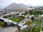
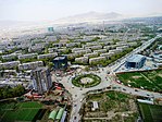
From top left to right: A mountain behind a built-up neighborhood; The Presidential Palace; Square with a large Soviet microdistrict in the background; Abdul Rahman Mosque; 16th-century Gardens of Babur | |
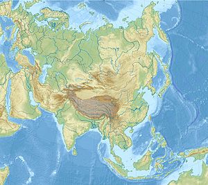
| Coordinates: 34°32′N 69°10′E / 34.533°N 69.167°E | |
| Country | |
| Province | Kabul |
| No. of districts | 22 |
| Capital formation | 1776 |
| Government | |
| • Type | Municipality |
| • Mayor | Abdullah Habibzai |
| Area | |
| • Total | 1,023 km2 (395 sq mi) |
| Elevation | 1,791 m (5,876 ft) |
| Population (2015) | |
| • Total | 4,635,000 |
| • Density | 4,500/km2 (12,000/sq mi) |
| Kabul urban agglomeration | |
| Demonym(s) | Kabuli, Kabulite |
| Time zone | UTC+4:30 (Afghanistan Standard Time) |
| Postal code | 100X, 101X, 105X, 106X |
| Area code | (+93) 20 |
| Climate | BSk |
| Website | km |
According to a 2012 estimate, the population of the city was around 3,289,000.[1] Ths includes Tajiks, Pashtuns, Hazaras and some other smaller ethnic groups.[2] It is the 64th largest and the 5th fastest growing city in the world.[3][4]
It is 1,800 meters, or 5,900 feet above-sea-level. Kabul is over 3,500 years old.
Districts

The city of Kabul is inside Kabul District - a district of Kabul Province. The city is also a municipality (shārwāli) - because it is also capital of a province; That municipality is divided into 22 administrative districts called municipal districts or city districts (nāhia); These districts (are the same, or) coincide with the official Police Districts (PD).[5]
Related pages
- Kabul Province
- Wahida Amiri, Afghan activist
References

Wikimedia Commons has media related to Kabul.
🔥 Top keywords: Main PageSpecial:Search0Slash (punctuation)BlackSpecial:RecentChanges4 (number)DavidSOLID (object-oriented design)Wikipedia:AboutFile:Sexual intercourse with internal ejaculation.webmHelp:ContentsHelp:IntroductionLisa Sparxxx2023 UEFA Champions League FinalColour24-hour clockAdolf Hitler UunonaBismillahir Rahmanir Raheem6 (number)T. N. SeshanFile:ASCII-Table-wide.svg20 (number)Poor Things (movie)United StatesCristiano RonaldoList of people who have walked on the MoonAli Malikov50 (number)17 (number)The Valley (2024 TV series)GrassList of mathematical symbolsList of U.S. states and territories by time zone8 (number)List of countries by areaWikipedia:Simple talkList of largest Hindu templesRama


